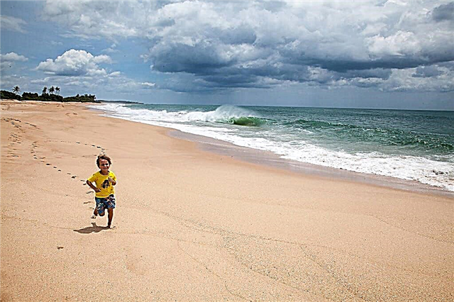
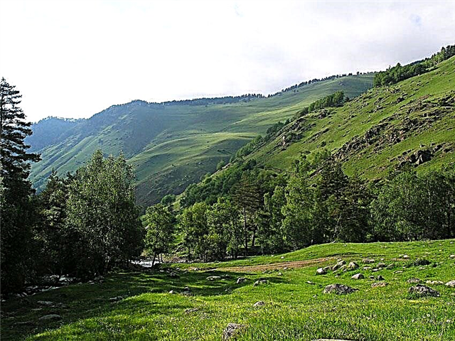
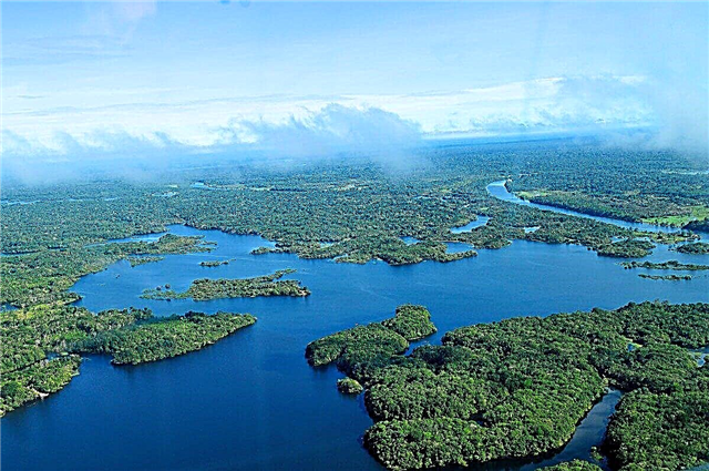
The subtropical climate of Brazil, together with geographical features, determines the presence of a large number of water resources in the country. The area of the Brazilian state is 8515 thousand km². The river network of the country is characterized as very dense and long. Highlands, rainforests and plains are dotted with small and large river systems that originate high in the mountains. Many of Brazil's rivers flow into the ocean.
The relief of Brazilian rivers consists of straight sections, rapids and waterfalls. The waterfalls in this area are real natural gems that form unique ecosystems around them. Water tourism in Brazil is well developed. There are boating stations, rafting clubs, kayaking and sailing places near large settlements. Due to the large supply of water resources in the country, there are no problems with the generation of electricity; shipping is one of the leading sectors of the economy.
The longest rivers in Brazil
List, photo with names and descriptions of the main waterways of the country.
Amazon
The deepest river on the planet. The basin area is 7180 thousand km². In 2011, the river was recognized as one of the seven wonders of the world. The Amazon is a border river. The largest area is in Brazil, the western part extends to Bolivia, Peru, as well as Ecuador and Colombia. The Amazon flows into the Atlantic, flows near the equator. The river also has the largest delta on earth.
The total length of the river is 6400 km

Zhurua
The source of the river is in Peru. The water area is 224 thousand km². Zhurua flows into the Amazon. Part of the river is navigable, the other part is filled with rapids and sharp bends in the channel. The Tefe tributary has an oil field.
The length of the river is 3280 km, in Brazil - 2900 km

Madeira
Formed on the border with Bolivia by the confluence of the Mamore and Beni rivers. The water area covers an area of 1,158 thousand km². The river flows into the Amazon. It is in this area that Amazonian dolphins live. The river bed is used for navigation. There are three major cities and several smaller settlements on the Madeira coast. The river also serves as a location for local hydroelectric power plants.
The length of the river is 3230 km, in Brazil - 1420 km

Purus
Right tributary of the Amazon. The total area of the water area is 365 thousand km². The waterway originates on the slope of the Andes. Further flows through the equatorial forests, flowing into the Amazon. The Purus river bed is notable for being the most winding on the planet. There are no large rapids at the river. The high water on Purus comes in March after the rainy season. In normal times, the average depth of the river does not exceed 15 meters.
The length of the river is 3200 km, in Brazil - 3050 km

Tocantins
The water area covers an area of 770 thousand km². The source is based in the east of Serra Dorada. The waterway is famous for the Guariba rapids. In the widest part, the waterway becomes navigable. There are 5 dams and several operating hydroelectric power plants on Tocantins. The shores of this water area are densely populated, there are cities such as Uruazu, Carolina, Maraba and other settlements.
River length - 2850 km

San Francisco
The third longest river in South America. The basin area is 641 thousand km². Some parts of São Francisco are suitable for extreme tourism. In the XX century, a cascade of hydroelectric power stations was built on the river. The start at São Francisco is in the heights of the Brazilian Highlands. The water area flows into the Atlantic Ocean. The waterfalls on the river reach 80 m. During the rainy season, the water level in this basin rises by 7 meters. Part of the river is navigable, the banks are considered inhabited.
River length - 2830 km

Araguaya
The water area is 370 thousand km². The river bed flows through the Brazilian Highlands. On its way, the water area is divided into two branches, between which the Bananal Island is located. The middle of the waterway is navigable. The lower Araguaia is endowed with rapids and small waterfalls and flows into the Tocantins.
River length - 2630 km

Paraguay
The waterway conventionally unites the territories of Paraguay and Brazil. The Paraguay River is the border between the two countries. During the dry months, Paraguay dries up locally, turning into swamps and lakes. During the rainy season, there is a strong flood of river waters. The river is navigated only in the area near Asuncion.
The length of the river is 2549 km, in Brazil - 1760 km

Rio Negro
The left tributary of the famous Amazon River. The territory of the river basin is 600 thousand km². The Rio Negru has the property of spilling over the nearby jungle for 35 km in both directions. The navigable section of the river is 600 km. It differs from its tributaries by large seasonal fluctuations in water level. The color of the waters of the Rio Negro is brown.
The total length of the river is 2300 km

Shingu
Right tributary of the Great Amazon. The river basin covers an area of 513 thousand km². Xingu is entirely located on the lands belonging to Brazil. The source is in the mountains of Mato Grosso. The porous area ends where the Amazonian Plain begins. At the point where the Xingu merges with the Amazon, shipping is possible. The river is fed by rain. At the headwaters of the Xingu, the National Park of the same name is open.
River length - 1980 km

Tapajos
The waterway is the result of the confluence of two rivers: Zhurueny and Telis-Piris. The main threshold of the waterway is Maranhao Grande. Further Tapajos flows through the lowlands and hills. The basin area is 487 thousand km². On its way, Tapajos meets the rainforests of the Amazon, the two Brazilian states of Amazonas and Pará. At the source of Tapajos there is a pole of inaccessibility with a location in South America.
River length - 1930 km

Itapikuru
The river flows through the state of Maranhao. The catchment area is estimated at 46,500 km². The river flows into the Bay of São Jose. It originates in the mountains of the Brazilian Highlands. There are oil palm plantations in the vicinity of the river basin. The waterway is navigable. Itapikuru is replenished by rainfall during the wet season.
River length - 1650 km

Solimunes
The border river delimits the territories of Peru and Brazil. The catchment area is 2200 thousand km². The river merges with the Rio Negru in the area of the city of Manaus. The navigable waterway is famous for its tourist opportunities. In the dry season, the depth of the mouth does not exceed 8 meters, in the rainy season it can reach 20 meters. On these waters, sightseeing excursions are regularly conducted, rolling tourists on motor ships along the tropical jungle.
The total length of the river is 1600 km

Uruguay
The border river forms the natural border of the Brazilian state with Uruguay. The basin area is 365 thousand km². It has a mouth width of 12 km. It has two large tributaries: the Rio Negru and the Ibikui. To the city of Salto, the channel is continuous rapids. Below this place, the Uruguay River becomes navigable. The waterway is of great importance in the country's water supply, and is also a source of hydropower resources.
The length of the river is 1600 km, in Brazil - 1200 km

Guaporé
Water canal flowing in Brazil next to Bolivia. Guaporé begins in the state of Mato Grosso and flows to the shores of the port of Alegre. The basin area is 266 thousand km². Most of the canal runs through the lowlands and Brazilian plains. There are few rapids along the river, Guaporé is suitable for ecological tourism.
The length of the river is 1530 km, in Brazil - 1380 km

Parnaiba
In the north-east of the country, this river is considered the largest. The pool covers an area of 344 thousand km². Parnaiba separates the states of Piaui and Maranhao. It originates in the Brazilian Highlands. There are many rapids in the upper part of the river, the lower course is more direct and full-flowing. The river delta is a nature conservation area. On the site near the city of Guadalupi, the river is blocked by a dam of a hydroelectric power station.
River length - 1400 km

Telis Piris
River in the northwest of the state.Telis Piris flows through Brazilian territories from west to east. It has a tributary, the Rio Cristalino. It flows into the Tapajos River. The type of food is rain-fed. The riverbed has a predominantly flat structure with a minimum number of rapids and turns.
River length - 1370 km

Iguazu
The river, the name of which is translated as "Big Water". The area of the Iguazu water area is 62 thousand km². The beginning of the river is worth looking for in the Serra do Mar mountains. The upper part of the mouth consists entirely of waterfalls and rapids. In total, there are about 70 waterfalls on the river, many of which are considered natural monuments of Brazil. Iguazu is the border between Argentina and Brazil. The river flows into Parana. In the lower reaches, it becomes navigable by 500 km. Various types of tourism are developed on the waters of Iguazu.
The total length of the river is 1320 km

Rio Grande
The beginning of the river is in the mountains near the Atlantic. The total area of the basin is approximately 170 thousand km². There are dams built on the river, forming two large reservoirs. There is also a cascade of hydroelectric power plants. The Rio Grande is a tributary of the Parana. The river bed runs through the Brazilian Highlands. In the upper reaches of the river, there are large and difficult to pass rapids. Navigation is open in the lower reaches of the mouth.
River length - 1230 km

Ruthai
Waterway through the Amazonian Plain. The water area is 60 thousand km². The lower reaches of the Zhutai River are considered navigable. A compact and small river is fed by rain. It flows into the Amazon. It flows through the state of Amazonas. The banks of Zhutai are inhabited, there are large villages and cities.
River length - 1200 km

Tiete
The river flows through the city of São Paulo. The basin area is 150 thousand km². Cruise shipping is well developed on Tiet. The source of the waterway is located in the Serra do Mar mountains. Tiete flows into the Parana River. The banks of the river are built up with settlements, where wild corners of nature are rarely found.
River length - 1150 km

Paraiba do Sul
The river flows through the state of São Paulo near the Atlantic coast. Paraiba do Sul flows into the Atlantic. The area of the water area is approximately 140 thousand km². The river is formed by the confluence of the Paraibuna with the Paraitinga. Floods and floods are possible on the river from October to April. The type of food is rain-fed.
River length - 1120 km

Iriri
The left tributary of the Xingu originates at Mato Grosso. The water area covers a part of dry tropical forests. Therefore, during the dry season, Iriri is shallow. Navigation on the waterway is possible only on small vessels, since rapids and sharp turns of the channel are encountered along the entire length of the waterway.
River length - 1100 km

Zhavari
The source of Javari is located in Peru. A waterway flows into the Amazon. Refers to the central rivers of Brazil. It is the natural border between Peru and Brazil. In the rainy season, Zhavari becomes navigable in all areas; in the dry months, a route of 500 km is open for ships. In 1930, a meteorite fell into the waters of Javari. After that, the river became world famous.
The total length of the river is 1056 km

Cuiaba
A small river that flows into Paraguay. The source of Cuiaba is located on the Mato Grosso plateau. The ecology of the river is very problematic: the water is polluted with industrial waste, industrial and sewage waste. Floods occur from October to May. Fishing on the canal is prohibited, as well as swimming in this reservoir.
River length - 980 km

Zhuruena
Left tributary Tapajos. The source is based in the Serra dos Paresis mountains. The banks of the river have almost no settlements on their territory. The river flows along the plateau. The winding riverbed includes rapids and waterfalls. The flood on Zhuruen runs from December to April. Many territories along which the river flows are poorly explored by man.
River length - 960 km

Paranapanema
This river unites two Brazilian states: Sao Paulo and Parana. Paranapanema flows into the Parana River. Near the town of Orinhos, there are two large reservoirs upstream and downstream of the river. The waterway originates from the Atlantic Ocean in the southeast of the state of São Paulo. Cruise excursions are conducted along the river, water transport competitions are organized.
River length - 929 km

Paranaiba
The source of the river that feeds Parana is located in the Serra da Canastra mountains. In the Brazilian Highlands, this river forms a valley with many waterfalls, lakes and rapids. Floods on the river begin in summer, sometimes small floods occur in the winter months. The area around the river is very picturesque. Water tourism is developed in these places, as well as recreation at the numerous waterfalls of Paranaiba.
River length - 900 km

Rio Dosi
The basin area is 834 thousand km². The source of the Ryu Dosi arises at the confluence of Piranga and Karmo. At the source of the river is the historic city of Ouro Preto. The river flows into the Atlantic. "High" water on the Rio Dosi is observed from October to May. The current is directed from west to east. In 2015, a dam burst on the river, and tons of industrial waste fell into the water. The water in Rio Dosi is saturated with mercury and arsenic, so there is no fishing.
River length - 853 km

Acri
The river basin is only 30 thousand km². The channel runs through Brazilian territories and Bolivia. The source is in the Peruvian Andes. Akri flows into the Purus. The Akri shipping section is 480 km long. In the rainy season, the river becomes completely navigable. Many settlements have been built along the banks of the river.
The total length of the river is 650 km