In addition to the Moskva River, which appears on the postcards, the rest of the capital's reservoirs are less known. Small and medium-sized rivers are characterized by an artificial change in the channel and confinement in underground collectors. This was done at one time when creating urban plans. Subsequently, in order to remind residents and tourists about the historical appearance of the city, an imitation of Neglinnaya was presented at Okhotny Ryad. And for diggers, underground collectors have become a real find and a favorite place for hiking.
Flowing along industrial zones, as well as being polluted by waste, some of the rivers became unusable for economic use. For example, Chermyanka is important only for the architectural and landscape view. One of the exceptions is Ichka, which is considered the cleanest in the entire region.
The longest rivers flowing in Moscow
List, photo with titles and descriptions!
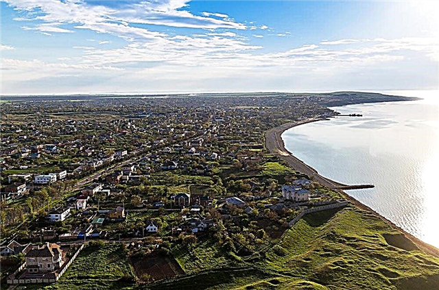
Moscow
The main river of the city, which gave it its name. The Moscow reservoir has three terraces above the floodplain. Walking along the river is one of the popular tourist routes. Cruises are organized on an ongoing basis and can be themed. This type of excursion allows you to see many sights of the capital from the water and outline the further path of acquaintance with those you especially like.
The length of the river is 473 km, in Moscow - 80 km.

Klyazma
The Oka tributary originates on the southern slope of the Klinsko-Dmitrovskaya Upland. In the past, the Klyazma was rich in water and played an important role as a waterway. The area is used to create recreational areas. Including built sanatoriums, recreation centers and health complexes, which are easily accessible from Moscow.
The length of the river is 686 km, in Moscow - 4 km.

Yauza
The largest tributary of Moscow is within the boundaries of the capital. The river is partly navigable. Of the fish, there are not only roach and perch, typical for the area, but also bleak. Many bridges have been built within the city, including 23 pedestrian bridges. The Lefortovo tunnel, which belongs to the third transport ring, runs under the Yauza. On the shore are the Catherine Palace and the building of the Bauman University.
The length of the river is 48 km, in Moscow - 27.6 km.

Gangway
Left tributary of Moscow. The main natural attraction of the river floodplain is the Skhodnenskaya bowl, located on the territory of the Tushinsky park. The forested parts of the coast attract tourists. There are many skiers here in winter. However, the dense building every year "takes away" more and more area from those who like walking in the fresh air.
The length of the river is 47 km, in Moscow - 5 km.

Pekhorka
An alternative name is Pehra. It originates in the Losiny Ostrov National Park. Downstream there are large ponds, including Alekseevsky. A specially protected area has been created along the river bed. In winter, it does not freeze completely. The reason lies in the discharge of wastewater from the Lyubiretskaya aeration station into the river. They are warm, so even severe frosts do not take Pekhorka in this area.
The total length of the river is 42 km.

Setun
The largest right tributary of Moscow. Unlike most of the capital's rivers, the Setun is “driven” into collectors, and its valley has not been artificially changed. A nature reserve has been formed on the river within the city. Its area is over 693 hectares. In the spring, Setun overflows heavily, even filling the old lady. A plan has been developed for the development of the recreational potential of the area.
The total length of the river is 38 km.

Likhoborka
The right tributary of the Yauza flows in the north of the capital. The river is used to flood Moscow with Volga water. Due to the built bypass canal, which received the name Golovinsky, the river began to be distinguished by its fast flow and high water content, which was not characteristic of it before. The Likhoborka estuary is a regional natural monument. Work is planned to clean up the banks and establish recreational areas here.
The total length of the river is 30.2 km.

Bitza
The name of the river was first mentioned in 1480. Hydronym means "wrap around" or "island". It is a left tributary of the Pakhra and originates in Vidnoye. The source is located in the southwest of the capital. In terms of pollution, the reservoir is heterogeneous. Particularly ecologically problematic areas belong to urban areas. The cleanest zones are the source and part of the channel in the area of the Upper Znamensky pond.
The total length of the river is 25 km.

Pine
After the expansion of Moscow in 2012, it was ranked among the capital's rivers. It is a tributary of the Desna and has two sources. The etymology of the name is associated with the pines that abundantly grew in this area in the past. Now some forest areas are also found, but not everywhere. 3 ponds were formed on the riverbed. A popular tourist route runs along the banks of the Sosenka.
The total length is 20 km.

Khimka
It flows in the northwest of the city. 9 km of length belongs to the Khimki reservoir. The runoff is regulated by a large earthen dam. The river valley is cut deeply, there are especially picturesque areas. There are many attractions on the shores: the park of the Pokrovskoye-Streshnevo estate, the Zakharkovo garden, and the Friendship Park. There are places where raft, ruff and perch are good at pecking.
The total length of the river is 18 km.

Gorodnya
Located in the southern part of Moscow. 14 km of river length - in an open channel. The river valley is picturesque. However, during the period of active development of the city and later, the channel was artificially changed. It has preserved its original appearance only at the Bitsevsky forest. Five sections of the valley are regional natural monuments. Gorodnya is a decoration of the city, although it is not used in economic activities and has no recreational value.
The length of the river is 16 km.

Churilikha
Left tributary of the Beggar. Enclosed in manifolds along almost the entire length. Forms 4 large ponds and several more small ones. Churilikha is born from the confluence of two streams. Thanks to the discovery of Vyatichi burial mounds in the river floodplain, the territory is popular with fans of this kind of attractions. A number of sections of the river are recognized as regional natural monuments.
The length of the river is 13.4 km.

Beggar
It has the largest number of tributaries from the small rivers of the capital. The very same flows into Moscow from the left bank. Most of the river is located in collectors. The source is a swamp near Izmailovsky Park. It flows near factory buildings. This and other reasons led to the deterioration of the ecology in the valley. The beggar is called the dirtiest river in the city and is used to float snow when cleaning.
The length of the river is 12.4 km.

Chertanovka
There are disputes over the ownership of the river: it is either a tributary of Moscow, or Gorodnya. 8.4 km of the river is an open channel. Chertanovka fully belongs to the territory of the capital. The source is located at the highest point of the city near the Tyoply Stan station. Following the declaration of the Upper reaches and the valley as a regional natural monument in 1991, a settling pond was created to purify the water.
The length of the river is 12 km.

Chermyanka
Located in the northern part of the capital. Approximately 7.6 km flows in the open channel in Moscow. The river is important for the architectural and landscape view of the city, but is not used for recreation and fisheries due to severe water pollution. The Chermyanka Valley from Dezhneva Street to the mouth, as well as from Shirokaya to Molodtsov, has been a natural monument of regional significance since 1991.
The length of the river is 12 km, in Moscow - 10.3 km.

Chachenka
The Moscow part of the channel is located in the Mozhaisky district of the city. There is a spring bog in the upper reaches. This site is the most polluted. On the banks, where the river flows openly, there are rare picturesque corners. Walking excursions are organized along the banks of the river. The site in the area of Romashkovsky pond is especially popular. Tours for fishermen are also organized here. Trout and sterlet have been artificially bred.
The total length of the river is 12 km.

Ichka
One of the cleanest regions. The drainage basin is located on the territory of one of the first national parks in Russia, Losiny Ostrov. A landscape reserve called "Valley of the Ichka River" has been created.On the banks there are plants listed in the Red Book, such as long-leaved buttercup and swimsuit. In some areas, roach, pike and crucian carp peck well.
The total length of the river is 12 km.

Serebryanka
Open channel - 3.7 km. The source is a swamp near the Moscow Ring Road. Since 1987, the Serebryanka valley has been declared a natural monument of regional significance. The area is famous for its undisturbed natural complexes. Thanks to them, the eastern part of the city, oversaturated with enterprises, has retained its attractive appearance. The river is the main source of water for the Izmailovsky Park.
The length of the river is 12.5 km, in Moscow - 9 km.

Luberka
The right tributary of the Pekhorka. The part of the channel, which is located on the territory of the capital, is enclosed in an underground collector. Diggers walked along and across it. The depth is just above the knee, there are areas with debris. The source of the river is located in a sewage ditch. In the past, the Lyuberka passed through the lake of the same name, but it dried up in the 60s of the last century.
The total length of the river is 10 km.

Filka
The name of the river can also be pronounced as Khvilka or Khilka. Refers to the number of tributaries of Moscow. Most of the 10 km of its length is enclosed in an underground reservoir. The Tatarovskaya Upland is divided by the river into the Krylatskie Hills and the Poklonskaya Gora. A small picturesque corner of Filki has survived not far from the Pionerskaya station - a pond with an island and a bridge.
The length of the river is 10 km.

Ochakovka
Left tributary of the Ramenki. The length is about 10 km, of which more than 2/3 is an open channel, and about 1.2 km flows through other bodies of water. In the floodplain of Ochakovka, there are 2 ponds with a total area of 7.6 hectares. These are fishing places where roach and perch peck. The banks of the river are especially landscaped in the area of the Tyoply Stan landscape reserve. Water pollution comes from nearby collectors, and so far the problem has not been brought under control.
The length of the river is 10 km.

Ramenka
The largest right tributary of the Setun. The name is given from the word "ramen", denoting the type of forest - dark coniferous or spruce forest with an admixture of birch and aspen. The source is located near the Vorontsov ponds. The channel about half of its total length is placed in an underground reservoir. The water is polluted by emissions of oil products. Partially, the river valley has the status of a specially protected natural area.
The length of the river is 9 km.

Kotlovka
Right tributary of Moscow. It is fed by large streams. In the middle course, the channel is open, otherwise the river is enclosed in an underground collector. There are rapids along the entire length, but small ones. Due to the strong pollution of the water, it is prohibited to swim in Kotlovka. The part of the river valley that belongs to the territory of the Korobkovsky Garden is a natural monument of regional significance.
The length of the river is 8.5 km.

Cockroach
Left tributary Moscow. Disputes continue over the belonging of the river to the number of Khodynka tributaries. It is almost completely underground, protruding only fragmentarily on the surface. The site near the Sokol station is especially heavily silted. The Tarakanovka collector is a popular place for diggers. Since there are dangerous areas, several expeditions of extreme sportsmen ended up with injuries.
The length of the river is 7.8 km.

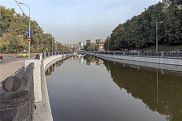
Neglinnaya
Historically it was the main river of Moscow and flows along the Kremlin wall. Now completely enclosed in an underground reservoir. Due to the peculiarities of operation, the water in the river is seriously polluted, and the situation is getting worse. Not far from Okhotny Ryad, an imitation of Neglinnaya was made over the previous channel: she was allegedly released to the surface. However, this is only an element of urban decor.
The length of the river is 7.5 km.